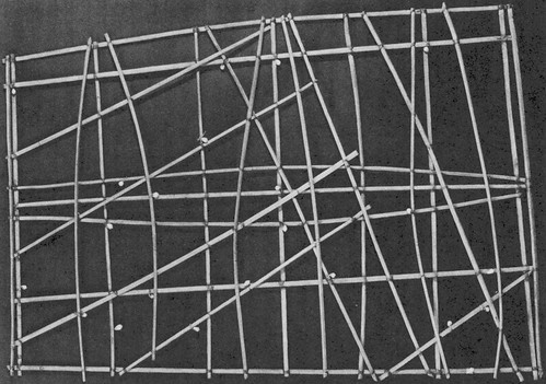
 a sea chart or stickchart of some of the Marshall Islands, showing the islands as the nodes (made of cowrie shells) , the swells as curved lines, and the currents as straight lines. This chart would have been used to teach navigation on shore
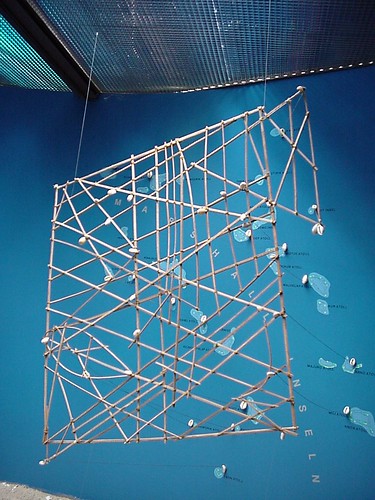 another stickchart of some of the Marshall Islands, this time made by a German dude as part of an exhibit... you can see that the cowries on the chart correspond (indeed, are actually linked with string) with a conventional map of the Marshall Islands on the wall behind... for the purposes of over-explanation...
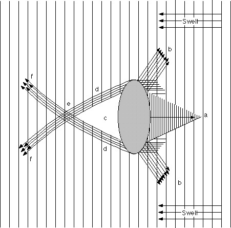 detail of chart outlining the relationship with swell and islands, again as a navigational tool... if you're at a point where the swells are behaving like (f), you are therefore able to calculate your relative position to the island...
 another stickchart, again showing islands as cowries, curved lines as island-refracted swells, and straight lines as currents
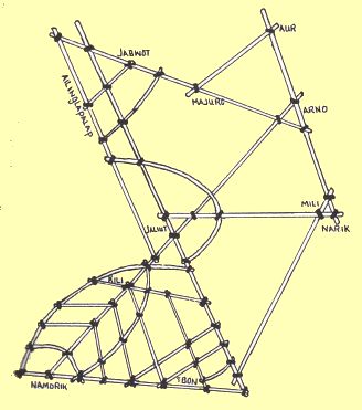 and another stickchart of the Marshalls... when I first saw these, I was a bit suspicious that they all had a boat outlined in them... me and my pea-sized brain... a boat is a refraction is a leaf is a swell-line...
Micronesian navigation is something I'm looking at because it seemed to be a very intricate and yet a very pliable form of navigation... a set of strategies for dealing with travel on highways constantly in flux - i.e. the ocean passages between the myriad of islands that is the Polynesian triangle...
The anecdote that nudged me in this direction was from my very wonderful friend, Annemarie Kohn, who mentioned to me the Micronesian navigational concept of a navigator or traveler remaining stationary in their canoe while 'pulling the sky past you', when traveling at sea. Apart from being an overwhelmingly romantic moment of magical realism, this concept really got to me.
It turns out that the Etak or Hatag system only employs this stationary/contingent system of navigation as a device, as a way of thinking about distance when traveling from one island to another... you, the navigator of the boat, are stationary in the universe, and by having intrinsic knowledge of the ocean, currents and placement of the stars and islands which you have learnt since you were young, you can twist, turn and push the universe around and past you, until your destination island shows up.
However... still within this system; if you figure out that your boat has gone off course, the universe becomes stationary and you become the moving object, until such a time as you have regained a sense of where you are in the system... at which point, you become stationary again, and continue to pull the sky past you...
There are so many deliciously un-European aspects to Polynesian navigation that it is truly stunning... and it makes my brain purrrrrr.
In sort-of but not-really complete contrast, all this has made me remember a reference to a passage by Rebecca Solnit in her seminal book A field guide to getting lost:
Malcolm... brought up the Wintu in north-central California, who don't use the words 'left' and 'right' to describe their own bodies but use the cardinal directions. I was enraptured by this description of a language and behind it a cultural imagination in which the self only exists in reference to the rest of the world, no you without mountains, without sun, without sky. As Dorothy Lee wrote, "When the Wintu goes up the river, the hills are to the west, the river to the east; and a mosquito bites him on the west arm. When he returns, the hills are still to the west, but, when he scratches his mosquito bite, he scratches his east arm." ... In Wintu, its the world that's stable, yourself that's contingent, there's nothing apart from its surroundings.
I've gathered the links I've found on micronesian navigation here...
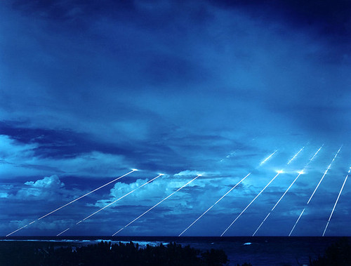 what's happening at the Marshall Islands these days... US missile testing
2 comments:
Actually, I thought that 2nd photo was the real thing, from the Hamburg Museum of Ethnology. It's perhaps the most often photographed stick map, but perhaps partially influenced by Western maps.
The older stick maps are less "map-like," and have more of the cool reflections and refractions.
hmm.. you may be right.. i'll look into it... cheers
Post a Comment